MAPS
A chart of vital ocean and sea statistics.
Use this worksheet to help students read map keys.
Using a map of the United States, children will identify the states with cold winters.
Learn about the Geography Hall of Fame with information on the world's largest continent, longest lagoon, and more!
The following table lists the approximate land area, highest elevation, and lowest elevation of the world's continents,…
Learn about the differences between climate maps, topographic maps, and others types of maps.
Blank outline map of Alabama.
Blank outline map of Alaska.
Blank outline map of Arizona.
Blank outline map of Arkansas.
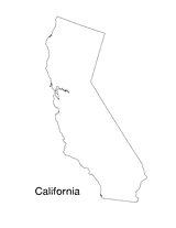
Blank outline map of California.
Blank outline map of Colorado.
Blank outline map of Connecticut.
This printable blank state map of Idaho is perfect for labeling, coloring, and practicing map skills. Use it as a…
Blank outline map of Illinois.
Blank outline map Indiana.
Use this blank map of “The Haweye State” to give your students a template for exploring Iowa. Students can add details…
This state map of Kansas can be colored and labeled as part of a quiz, test, or project. The blank black and white…
Blank outline map of Kentucky.
This state map of Louisiana can be colored and labeled as part of a quiz, test, or project. The blank black and white…
Blank outline map of Maine.
Blank outline map of Maryland.
Blank outline map of Massachusetts.
Blank outline map of Michigan.